Neighbourhood guide · Southwest Edmonton
Cameron Heights, Edmonton: river valley homes off the Henday
Cameron Heights sits between Wedgewood Ravine and the North Saskatchewan River valley, with Anthony Henday Drive along its southern edge and Cameron Heights Drive as its only road in. Building started in the early 2000s, and in the 2021 Census nearly nine in ten of its 710 occupied homes were single-detached houses, most of them built after 2005.
- Wedgewood Ravine trail
- Cameron Heights Park
- E.L. Smith Water Treatment Plant
- North Saskatchewan River valley
- Anthony Henday Drive
- Residents
- 2,250
- 2021 Census
- Households that rent
- 7%
- 2021 Census
- Renters' median monthly shelter cost
- $2,460
- Rent plus utilities, 2021
- Median home value
- $600,000
- Owners' estimates, 2021
- Completed secondary-suite permits
- 17
- City of Edmonton records
- Drive from our office
- 21 min
- 17.7 km, without traffic
Living here
Life in Cameron Heights
Ravines and river valley set the shape of Cameron Heights. Wedgewood Ravine wraps its north and west sides, the North Saskatchewan River valley runs along the east, and the City's profile names two more ravine systems close by, Cameron Ravine and Smith Road Ravine. Streets come in families off Cameron Heights Way and Cameron Heights Drive: Cameron Heights and Cameron Ravine courts, coves and landings, plus Caldwell, Chahley and Clement. Cameron Heights Drive leaves at the south end and meets Anthony Henday Drive at the interchange shared with Maskêkosihk Trail.
Cameron Heights Park, on Cameron Heights Way near the middle of the neighbourhood, is the central green the City planned as the community's focal point, and the Cameron Heights Community League gives the same address. From trailhead parking at Chahley Landing, the paved Wedgewood Ravine trail crosses to Wedgewood Heights, about a kilometre each way. Households are large: the 2021 Census counted about 2,250 residents with an average of 3.2 people per household and a median age of 39.6, and the neighbourhood has both a community league and a homeowners' association.
Errands mean leaving the neighbourhood. No school operates inside it today, although the City's neighbourhood profile says the central park area is intended to house an elementary school and a community facility. The nearest schools are about 2 km north in Dechene and Jamieson Place, and West Edmonton Mall is around 14 minutes away by car without traffic. In the river valley just east sits EPCOR's E.L. Smith Water Treatment Plant, one of the city's two water treatment plants, with the kīsikāw pīsim solar farm on the same site since 2022.
How Cameron Heights came to be
The neighbourhood is named for John Cameron, a merchant who arrived in Edmonton from Winnipeg in 1881, became the first president of the city's Board of Trade, chaired the Edmonton School Board and was one of the first members of Town Council, in 1892 and 1895. He lived at the north end of the road that now bears his name, Cameron Avenue. The City set the Cameron Heights boundary in September 2003, and homes began going up in the early 2000s. Anthony Henday Drive's river bridges opened in November 2005 and the Cameron Heights Drive interchange was finished in late 2011; more than nine in ten homes counted in the 2021 Census were built from 2006 on.
Landmarks
Places that define Cameron Heights
Wedgewood Ravine trail
Wedgewood Ravine curves around the north and west sides of Cameron Heights. From the trailhead parking at Chahley Landing, a paved path with a hill at each end crosses the ravine to Lessard Road and 184 Street, about 1 km each way.
Cameron Heights Park
The central park at 3250 Cameron Heights Way sits in the middle of the neighbourhood. The City planned this central area as the community's focal point, and the Cameron Heights Community League lists the same address.
E.L. Smith Water Treatment Plant
EPCOR's plant on the North Saskatchewan River, east of Cameron Heights and northeast of the Henday, is one of Edmonton's two water treatment plants. It has supplied drinking water since 1976 and was upgraded in 2008.
kīsikāw pīsim solar farm
EPCOR's solar farm on the E.L. Smith site, in the river valley beside the neighbourhood, was commissioned in fall 2022. Its roughly 31,000 panels are expected to produce more than 20,000 megawatt hours of electricity a year.
Henday river bridges
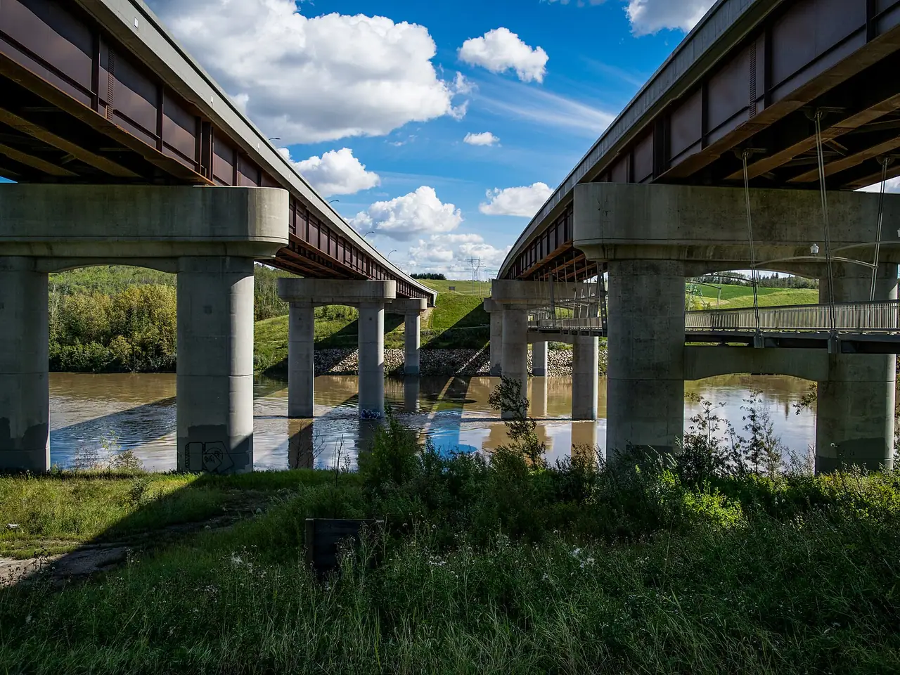
Anthony Henday Drive's twin bridges cross the North Saskatchewan about 1.6 km southeast of the neighbourhood's centre. Opened in 2005, they were named in 2024 the Constable Travis Jordan Memorial Bridge (eastbound) and Constable Brett Ryan Memorial Bridge (westbound).
Good Shepherd Catholic Elementary School
Edmonton Catholic Schools elementary school on 57 Avenue NW in Dechene, roughly 1.9 km north of Cameron Heights' centre by straight line. It is one of the closest schools for families in the neighbourhood.
S. Bruce Smith School
The closest public junior high, for Grades 7 to 9, at 5545 184 Street NW in Dechene, about 1.8 km north of the centre of Cameron Heights. Its programs include Academic Enrichment and Interactions.
Buying & selling
Homes in Cameron Heights
Cameron Heights is overwhelmingly detached. In the 2021 Census, single-detached houses made up 86.6% of occupied dwellings, row houses 10.6% (about 75 units) and semi-detached homes 2.1%, with no apartments at all. About 65 households lived in condominium units, which here means townhouse-style or other ground-level homes. Almost everything is recent: about 250 homes date from 2006 to 2010, 240 from 2011 to 2015 and 130 from 2016 to 2021. Owners put the median value of their homes at $600,000 in 2021, matching Wedgewood Heights across the ravine.
Newer homes call for different checks than older ones. For a house built in the last decade, ask for the builder's warranty documents and find out which coverage periods remain. Because Cameron Heights has a homeowners' association as well as a community league, ask what the HOA covers, what it charges and whether the obligation is registered on title. For a townhouse condo, review the reserve fund study, the bylaws and recent board minutes. Our office is 17.7 km away, about 21 minutes without traffic, and Realty72 can list your home on the MLS® System and REALTOR.ca, priced with a comparative market analysis.
Buying? Browse Edmonton homes for sale and work out payments with our mortgage calculator. Selling? See how we sell Edmonton homes. Looking to rent? See our houses and suites for rent.
- Single-detached houses87%
- Row houses11%
- Semi-detached houses2%
Share of occupied homes. Statistics Canada, 2021 Census.
- 2001–20057%
- 2006–201038%
- 2011–201536%
- 2016–202120%
Share of occupied homes by construction period. 2021 Census.
Landlords & investors
Renting out a home in Cameron Heights
Very few homes are rented. Renters made up about 6.7% of households in 2021, roughly 45 of 675, and renters' median monthly shelter cost was $2,460 in 2021. With no apartment buildings in the neighbourhood, those renters were living in houses, townhouses or suites. The City's records show 17 completed secondary-suite permits in Cameron Heights, the first issued in 2013 and the most recent in 2024, so legal suites exist but remain uncommon.
A rental here suits a household with a car. The fall 2026 ETS schedule shows no regular bus stops inside Cameron Heights, and the nearest LRT station, South Campus/Fort Edmonton Park, is 7.7 km away in a straight line. For an up-and-down rental, plan parking for both units, and keep the suite's permit records ready for applicants. Realty72's property management service can set the rent from market research, photograph and advertise the home on rental websites, screen applicants online and provide 24-hour emergency service for tenants.
How Realty72 manages rentals
Market rent pricing
We research the correct market rent for your property and neighbourhood before it is advertised.
Marketing & showings
Professional photos, ads on the top rental websites, and showings booked and attended by our team.
Tenant screening
Every applicant goes through our rental application process before we recommend them to you.
Maintenance & 24-hour emergencies
Online repair requests, long-standing local vendors, and emergency service for tenants around the clock.
Location
Where Cameron Heights is
Cameron Heights, Edmonton, AB
FAQ
Cameron Heights: common questions
How many roads lead into Cameron Heights?
One. Cameron Heights Drive is the only road into the neighbourhood, running from its south end to the Anthony Henday Drive interchange at exit 12, where Maskêkosihk Trail heads west. That keeps through traffic out, but every car trip, school run and delivery uses the same route, which is worth weighing if you commute at peak times.
Is there a school in Cameron Heights?
Not at present. The City's neighbourhood profile says the central park area is intended to house an elementary school and a community facility, but no school operates there today. The nearest schools are about 2 km north in Dechene, including S. Bruce Smith School for Grades 7 to 9 and Good Shepherd Catholic Elementary School. Confirm designated schools with each board before buying.
What is the E.L. Smith site next to Cameron Heights?
It is EPCOR's E.L. Smith Water Treatment Plant, which has provided drinking water to Edmonton since 1976 and was upgraded in 2008. It sits in the river valley east of the neighbourhood. The same site holds the kīsikāw pīsim solar farm, commissioned in fall 2022 with about 31,000 panels.
Does Cameron Heights have a homeowners' association?
Yes. The Cameron Heights Community League notes that the neighbourhood has both a homeowners' association and a community league, and the two are separate organizations. Before buying, ask the seller or your lawyer what the HOA fee is, what it pays for and whether it is registered on the title.
Who lives in Cameron Heights?
Mostly homeowners in larger households. In the 2021 Census about 2,250 residents lived in 675 households, an average of 3.2 people each, and about 93% of households owned their home. The median age was 39.6 and the median household income in 2020 was $182,000.
Sources and data
- City of Edmonton: Cameron Heights Neighbourhood Profile
- Edmonton Historical Board: Cameron Heights
- Wikipedia: Cameron Heights, Edmonton
- Cameron Heights Community League
- EPCOR: E.L. Smith Water Treatment Plant
- EPCOR: kīsikāw pīsim solar farm
- Edmonton Police Service: Bridges renamed for Constables Travis Jordan and Brett Ryan
- Wikipedia: Anthony Henday Drive (interchanges and history)
- Wikipedia: Alberta Highway 627 (Maskêkosihk Trail)
- River Valley Alliance: Trail Trek How-to, Wedgewood Ravine
- Edmonton Public Schools: S. Bruce Smith School
- Edmonton Catholic Schools: Good Shepherd Catholic Elementary School
- Edmonton Transit Service schedule data (GTFS feed, fall 2026)
Figures: Statistics Canada, 2021 Census of Population, tabulated by neighbourhood in City of Edmonton Open Data; Statistics Canada rounds counts, and tenure, build periods, costs and values are 25% sample data. Suite permits: the City's "Secondary Suites (Completed Permits)" records. Drive time: OpenStreetMap routing from our office, without traffic. Page updated November 7, 2026.